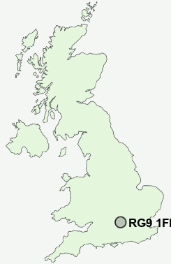
Postcode : RG9 1FR, Henley-on-Thames, Oxfordshire
Henley-on-Thames, Oxfordshire.
RG9 1FR close to Henley-on-Thames, Woodlands and Newtown.


Classification
RG9 1FR : Cosmopolitans / Comfortable cosmopolitan / Migrant families
Local Authority South Oxfordshire
Primary Care Trust Oxfordshire
Ward Henley-on-Thames
Constituency Henley
Region South East
Country England
Postcode Area RG : Reading
RG9 Postcode Sectors
RG9 3 Aston, Greenlands, Lower Shiplake, Remenham, Remenham Hill
RG9 4 Binfield Heath, Broadplat, Crowsley, Greys Green, Harpsden
RG9 6 Bix, Colstrope, Cookley Green, Fawley, Fawley Bottom
RG9 4 Binfield Heath, Broadplat, Crowsley, Greys Green, Harpsden
RG9 6 Bix, Colstrope, Cookley Green, Fawley, Fawley Bottom
RG9 5 Catslip, Crocker End, Highmoor, Highmoor Cross, Huntercombe End
RG9 2 Henley-on-Thames, Woodlands
RG9 1 Newtown
RG9 2 Henley-on-Thames, Woodlands
RG9 1 Newtown
RG9 1FR Nearby Postcode Districts
HP10 HP11 HP12 HP13 HP9 OX10 OX11 RG1 RG10 RG30 RG31 RG4 RG5 RG6 RG8 RG9 SL0 SL1 SL2 SL3 SL4 SL6 SL7 SL8 SL9 TW19
Stations near to RG9 1FR
Henley-on-Thames Rail StationShiplake Rail Station about 1.77 miles away.
Wargrave Rail Station about 2.71 miles away.
RG9 1FR Schools
St Mary's SchoolTrinity Church of England Primary School
Sacred Heart Catholic Primary School, Henley-on-Thames
Rupert House School
Badgemore Primary School
Valley Road School
Gillotts School
UK Search
Antique Furniture
1000s of pieces of Antique Furniture for sale from British antique dealers.
