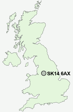
Postcode : SK14 6AX, Hyde, Tameside, Greater Manchester
Market Street, Broadbottom, Hyde.
SK14 6AX close to Mudd, Broadbottom and Hattersley.


Classification
SK14 6AX : Urbanites / Urban professionals and families / White professionals
Local Authority Tameside
Primary Care Trust Tameside and Glossop
Ward Longdendale
Constituency Stalybridge and Hyde
Region North West
Country England
Postcode Area SK : Stockport
SK14 Postcode Sectors
SK14 5 Backbower, Gee Cross
SK14 3 Broadbottom, Godley Hill, Hattersley, Werneth Low
SK14 4 Flowery Field, Kingston, Newton
SK14 2 Godley
SK14 3 Broadbottom, Godley Hill, Hattersley, Werneth Low
SK14 4 Flowery Field, Kingston, Newton
SK14 2 Godley
SK14 8 Hollingworth, Woolley Bridge
SK14 1 Hyde
SK14 6 Landslow Green, Mottram in Longdendale, Mudd, Warhill
SK14 1 Hyde
SK14 6 Landslow Green, Mottram in Longdendale, Mudd, Warhill
SK14 6AX Nearby Postcode Districts
M1 M11 M12 M13 M14 M15 M16 M17 M18 M19 M2 M20 M21 M22 M23 M25 M27 M28 M3 M30 M32 M33 M34 M35 M4 M40 M41 M43 M5 M6 M60 M7 M8 M9 M90 OL5 OL6 OL7 OL8 OL9 S33 S36 SK1 SK12 SK13 SK14 SK15 SK16 SK2 SK22 SK3 SK4 SK5 SK6 SK7 SK8 WA14 WA15
Stations near to SK14 6AX
Broadbottom Rail StationHattersley Rail Station about 1.22 miles away.
Dinting Rail Station about 1.8 miles away.
Godley Rail Station about 1.92 miles away.
Hadfield Rail Station about 2.35 miles away.
Marple Rail Station about 3.35 miles away.
SK14 6AX Schools
Pinfold Primary SchoolMottram CofE Primary School
Arundale Primary School
St Margaret's Catholic Primary
Gamesley Community Primary School
Hollingworth Primary School
Longdendale High School
UK Search
Antique Furniture
1000s of pieces of Antique Furniture for sale from British antique dealers.