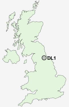
Postcode : DL1, Darlington
Postcodes in the DL1 sector. Covering areas such as Marrick, Kinninvie, Chilton, Low Row, Scargill, Clints, Westerton, Tow Law, Stainton, Newfield, Coundongate, Middleton Tyas, Barton, Wearhead, Helmington Row, North Yorkshire, County Durham and Darlingto.
Postcode Area DL : Darlington
DL1 Postcode Sectors
DL1 Nearby Postcode Districts
DL1 DL11 DL2 DL3 DL4 DL5 TS1 TS15 TS16 TS17 TS18 TS19 TS2 TS20 TS21 TS22 TS23 TS3 TS4 TS5 TS6 TS7 TS8 TS9
Stations near to DL1
Darlington Rail Station about 0.8 miles away.North Road Rail Station about 0.84 miles away.
DL1 Schools
St Aidan's Church of England AcademySt Aidan's Church of England Academy
Heathfield Primary School
Gurney Pease Primary School
Red Hall Primary School
Haughton Community School
Springfield Primary School
North Road Primary School
Reid Street Primary School
Whinfield Primary School
Longfield School
Abbey Junior School
UK Search
Antique Jewellery
including Antique Engagement Rings for sale from UK Antique specialists.