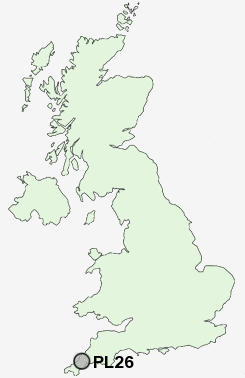
Postcode : PL26, Cornwall
Postcodes in the PL26 sector. Covering areas such as Foxhole, Gorran Churchtown, St Mewan, Trelowth, London Apprentice, Treviscoe, Carpalla, Higher Porthpean, Whitemoor, Mount Pleasant, Portmellon, Lower Menadue, Bodwen, St Michael Caerhays, Treveor and Cornwall.
Postcode Area PL : Plymouth
PL26 Postcode Sectors
PL26 8 Belowda, Bilberry, Bodwen, Bowling Green, Bugle
PL26 6 Boswinger, East Portholland, Gorran Churchtown, Gorran Haven, Gorran High Lanes
PL26 6 Boswinger, East Portholland, Gorran Churchtown, Gorran Haven, Gorran High Lanes
PL26 Nearby Postcode Districts
PL13 PL22 PL23 PL24 PL25 PL26 TR1 TR2 TR4 TR5 TR6 TR7 TR8 TR9
Stations near to PL26
St Austell Rail Station about 1.58 miles away.PL26 Schools
St Mewan Community Primary SchoolPondhu Primary School
Poltair School
UK Search
Antique Furniture
1000s of pieces of Antique Furniture for sale from British antique dealers.