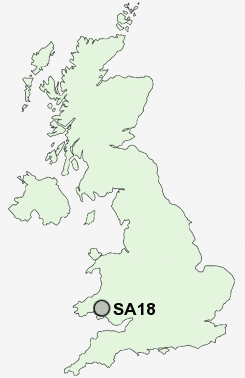
Postcode : SA18, Carmarthenshire, Neath Port Talbot
Postcodes in the SA18 sector. Covering areas such as Greynor, Greynor-isaf, Ammanford, Lower Brynamman, Garn-swllt, Garnant, Rhosaman, Twynmynydd, Dre-fach, Pantyffynnon, Myddyn-fych, Upper Brynamman, Saron, Betws, Pontamman and Carmarthenshire in Neath Port Talbot, Swansea.
Postcode Area SA : Swansea
SA18 Postcode Sectors
SA18 3 Ammanford, Blaenau, Cae'r-bryn, Capel Hendre, Greynor
SA18 2 Betws, Dre-fach, Garn-swllt, Garnant, Hendrewen
SA18 2 Betws, Dre-fach, Garn-swllt, Garnant, Hendrewen
SA18 Nearby Postcode Districts
SA14 SA15 SA17 SA18 SA31 SA32 SA8 SA9
Stations near to SA18
Ammanford Rail Station about 1.66 miles away.Pantyffynnon Rail Station about 2.14 miles away.
Llandybie Rail Station about 2.52 miles away.
UK Search
Antique Furniture
1000s of pieces of Antique Furniture for sale from British antique dealers.