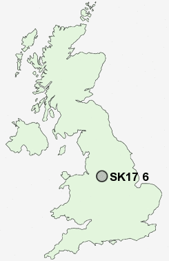
Postcode : SK17 6, Derbyshire
Postcodes in the SK17 6 district. Covering areas such as Canholes, Ladmanlow and Derbyshire.
Postcode Area SK : Stockport
SK17 Postcode Sectors
SK17 0 Biggin, Brund, Colshaw, Crowdicote, Earl Sterndale
SK17 9 Blackwell, Brushfield, Burbage, Chelmorton, Cowlow
SK17 7 Buxton, Fairfield, Tomthorn
SK17 9 Blackwell, Brushfield, Burbage, Chelmorton, Cowlow
SK17 7 Buxton, Fairfield, Tomthorn
SK17 6 Nearby Postcode Districts
CW12 DE45 S32 SK10 SK11 SK17 SK23 SK9
Stations near to SK17 6
Buxton Rail Station about 1.65 miles away.SK17 6 Schools
Buxton Community SchoolBurbage Primary School
Harpur Hill Primary School
Buxton Junior School
Buxton Infant School
St Thomas More Catholic School Buxton
St Anne's Catholic Primary School
Fairfield Infant and Nursery School
UK Search
Antique Furniture
1000s of pieces of Antique Furniture for sale from British antique dealers.