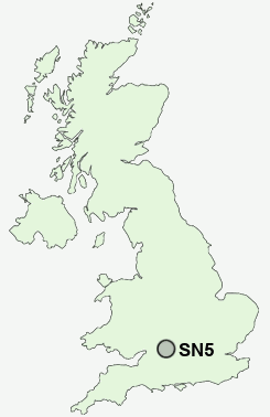
Postcode : SN5, Swindon, Wiltshire
Postcodes in the SN5 sector. Covering areas such as Grange Park, Lydiard Tregoze, Purton Common, Lydiard Plain, Hayes Knoll, Purton, Restrop, Roughmoor, The Fox, Nine Elms, Purton Stoke, Shaw, Freshbrook, Lydiard Millicent and Swindon in Wiltshire.
Postcode Area SN : Swindon
SN5 Postcode Sectors
SN5 3 Common Platt, Grange Park, Lydiard Green, Lydiard Millicent, Lydiard Tregoze
SN5 8 Freshbrook, Toothill
SN5 4 Hayes Knoll, Purton, Purton Common, Purton Stoke, Restrop
SN5 8 Freshbrook, Toothill
SN5 4 Hayes Knoll, Purton, Purton Common, Purton Stoke, Restrop
SN5 Nearby Postcode Districts
GL8 SN1 SN14 SN15 SN16 SN2 SN25 SN26 SN3 SN4 SN5 SN6 SN7
SN5 Schools
Tregoze Primary SchoolShaw Ridge Primary School
Brook Field Primary School
Westlea Primary School
Toothill Primary School
Millbrook Primary School
Even Swindon Primary School
Robert Le Kyng Primary School
UK Search
Antique Furniture
1000s of pieces of Antique Furniture for sale from British antique dealers.
