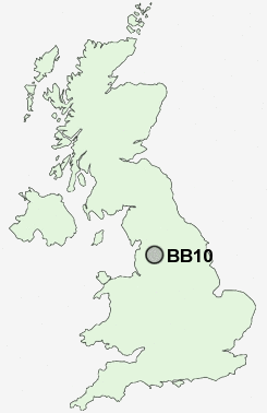
Postcode : BB10, Lancashire
Postcodes in the BB10 sector. Covering areas such as Holme Chapel, Lane Bottom, Over Town, Hurstwood, Cockden, Brownside, Pike Hill, Reedley, Burnley Lane, Worsthorne, Haggate, Brunshaw, Mereclough, Harle Syke and Lancashire.
Postcode Area BB : Blackburn
BB10 Postcode Sectors
BB10 Nearby Postcode Districts
BB1 BB10 BB11 BB12 BB2 BB4 BB5 BB6 BB7 BB8 BB9 BD13 BD15 BD16 BD20 BD21 BD22 HX1 HX2 HX3 HX7 OL13 OL14
Stations near to BB10
Burnley Central Rail Station about 1.12 miles away.Burnley Manchester Road Rail Station about 1.56 miles away.
Burnley Barracks Rail Station about 1.69 miles away.
Brierfield Rail Station about 1.87 miles away.
Nelson Rail Station about 2.5 miles away.
BB10 Schools
Sir John Thursby Community CollegeBurnley Heasandford Primary School
Thomas Whitham Sixth Form
Barden Primary School
Burnley Stoneyholme Community Primary School
Briercliffe Primary School
Reedley Primary School
Brierfield Walter Street Primary School
Marsden Heights Community College
UK Search
Antique Clocks
Browse Antique Clocks for sale from British antique dealers.