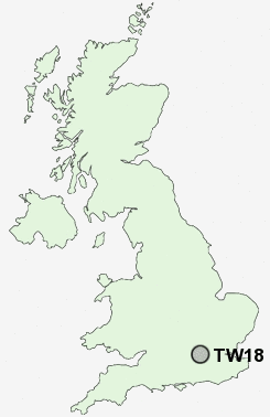
Postcode : TW18, Surrey
Postcodes in the TW18 sector. Covering areas such as Knowle Green, Laleham, Staines and Surrey.
Postcode Area TW : Twickenham
TW18 Postcode Sectors
TW18 Nearby Postcode Districts
CR4 CR8 EC1N EC1R EC4A EC4Y GU15 GU17 GU18 GU19 GU20 GU24 GU25 GU46 GU47 KT1 KT10 KT11 KT12 KT13 KT14 KT15 KT16 KT17 KT19 KT2 KT3 KT4 KT5 KT6 KT7 KT8 KT9 RG10 RG12 RG40 RG41 RG42 RG45 RG5 SE11 SL0 SL1 SL3 SL4 SL5 SL6 SM1 SM2 SM3 SM4 SM5 SM6 SW1 SW10 SW11 SW12 SW13 SW14 SW15 SW16 SW17 SW18 SW19 SW1A SW1E SW1H SW1P SW1V SW1W SW1X SW1Y SW2 SW20 SW3 SW4 SW5 SW6 SW7 SW8 SW9 TW1 TW10 TW11 TW12 TW13 TW14 TW15 TW16 TW17 TW18 TW19 TW2 TW20 TW3 TW4 TW5 TW6 TW7 TW8 TW9 UB1 UB11 UB2 UB3 UB4 UB7 W1 W10 W11 W12 W13 W14 W1B W1C W1D W1F W1G W1H W1J W1K W1M W1S W1T W1U W1W W2 W3 W4 W5 W6 W7 W8 W9 WC1 WC1A WC1B WC1E WC1H WC1N WC1R WC1V WC1X WC2 WC2A WC2B WC2E WC2H WC2N WC2R
Stations near to TW18
Staines Rail Station about 0.33 miles away.Ashford (Surrey) Rail Station about 1.74 miles away.
Egham Rail Station about 1.75 miles away.
Wraysbury Rail Station about 2.57 miles away.
Chertsey Rail Station about 2.83 miles away.
Heathrow Terminal 5 Rail Station about 2.98 miles away.
Heathrow Airport Terminal 5 about 3.07 miles away.
TW18 Schools
Kingscroft Junior SchoolKnowle Park Infant School
The Magna Carta School
Hythe Primary School
The Matthew Arnold School
Thorpe Lea Primary School
Shortwood Infant School
Ashford Park Primary School
Manorcroft Primary School
UK Search
Antique Furniture
1000s of pieces of Antique Furniture for sale from British antique dealers.