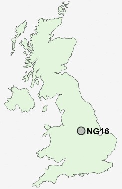
Postcode : NG16, Nottinghamshire
Postcodes in the NG16 sector. Covering areas such as Moorgreen, Brinsley, New Eastwood, Stoneyford, Selston, Jacksdale, Woodlinkin, Selston Green, Eastwood, Langley Mill, Bogend, Friezeland, Greasley, Bagthorpe, Shipley Gate and Nottinghamshire in Derbyshire.
Postcode Area NG : Nottingham
NG16 Postcode Sectors
NG16 4 Aldercar, Langley Mill, Woodlinkin
NG16 6 Alma, Dove Green, Pinxton, Selston, Selston Common
NG16 2 Awsworth, Babbington, Beauvale, Cossall, Cossall Marsh
NG16 6 Alma, Dove Green, Pinxton, Selston, Selston Common
NG16 2 Awsworth, Babbington, Beauvale, Cossall, Cossall Marsh
NG16 5 Bagthorpe, Barrows Green, Brinsley, Codnor Park, Friezeland
NG16 1 Bogend, Nuthall, Watnall
NG16 3 Eastwood, Eastwood Hall, Hill Top, New Eastwood, Shipley Gate
NG16 1 Bogend, Nuthall, Watnall
NG16 3 Eastwood, Eastwood Hall, Hill Top, New Eastwood, Shipley Gate
NG16 Nearby Postcode Districts
DE21 DE22 DE4 DE5 DE55 DE56 DE7 DE75 NG1 NG13 NG14 NG15 NG16 NG17 NG2 NG25 NG3 NG4 NG5 NG6 NG7 NG8
Stations near to NG16
Langley Mill Rail Station about 1.67 miles away.NG16 Schools
Lawrence View Primary and Nursery SchoolEastwood Infant and Nursery School
Eastwood Junior School
Eastwood Comprehensive School
Brinsley Primary and Nursery School
UK Search
Antique Furniture
1000s of pieces of Antique Furniture for sale from British antique dealers.