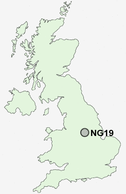
Postcode : NG19, Nottinghamshire, Derbyshire
Postcodes in the NG19 sector. Covering areas such as Pleasley, Moorhaigh, Forest Town, Mansfield Woodhouse, Newlands, Ladybrook, Stony Houghton, Pleasleyhill, Sookholme, New Houghton, Radmanthwaite and Nottinghamshire in Derbyshire.
Postcode Area NG : Nottingham
NG19 Postcode Sectors
NG19 7 Moorhaigh, Pleasley, Pleasleyhill, Radmanthwaite
NG19 8 New Houghton, Sookholme, Stony Houghton
NG19 8 New Houghton, Sookholme, Stony Houghton
NG19 Nearby Postcode Districts
DE4 DE55 NG17 NG18 NG19 NG20 NG21 NG22 NG23 NG24 NG25 S40 S41 S42 S44 S45
Stations near to NG19
Mansfield Woodhouse Rail Station about 0.32 miles away.Mansfield Rail Station about 1.24 miles away.
Shirebrook Rail Station about 3.06 miles away.
Sutton Parkway Rail Station about 3.76 miles away.
NG19 Schools
Nettleworth Infant and Nursery SchoolLeas Park Junior School
The Manor School
Peafield Lane Primary and Nursery School
Heatherley Primary School
Crescent Primary School
Rosebrook Primary School
Asquith Primary School
Forest Town Primary School
Holly Primary School
UK Search
Antique Furniture
1000s of pieces of Antique Furniture for sale from British antique dealers.