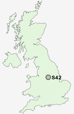
Postcode : S42, Derbyshire
Postcodes in the S42 sector. Covering areas such as Williamthorpe, Upper Loads, Hepthorne Lane, Alton, Wingerworth, Slatepit Dale, Old Brampton, Moorhall, Wigley, Freebirch, Oxton Rakes, Corbriggs, Old Tupton, Wadshelf, Nether Loads and Derbyshire.
Postcode Area S : Sheffield
S42 Postcode Sectors
S42 6 Alton, Nether Moor, Northedge, Old Tupton, Press
S42 5 Corbriggs, Grassmoor, Hepthorne Lane, Highfields, Holmewood
S42 5 Corbriggs, Grassmoor, Hepthorne Lane, Highfields, Holmewood
S42 Nearby Postcode Districts
DE4 DE45 DE55 NG17 NG18 NG19 NG20 NG21 S18 S32 S40 S41 S42 S43 S44 S45 S80
Stations near to S42
Chesterfield Rail Station about 2.57 miles away.S42 Schools
Deer Park Primary SchoolTupton Primary and Nursery School
Spire Nursery and Infant School
Hasland Junior School
Hasland Hall Community School
Tupton Hall School
Hasland Infant School
Spire Junior School
Deincourt Community School
North Wingfield Primary and Nursery School
Whitecotes Primary School
UK Search
Antique Furniture
1000s of pieces of Antique Furniture for sale from British antique dealers.