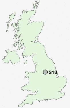
Postcode : S18, Derbyshire
Postcodes in the S18 sector. Covering areas such as Gosforth Valley, Barlow, Mickley, Millthorpe, Dronfield, Unthank, Cartledge, Crowhole, Unstone, Holmesdale, Hill Top, Hundall, Dronfield Woodhouse, Hallowes and Derbyshire.
Postcode Area S : Sheffield
S18 Postcode Sectors
S18 4 Apperknowle, Hundall, Summerley, Unstone, Unstone Green
S18 7 Barlow, Bole Hill, Brindwoodgate, Cartledge, Common Side
S18 3 Coal Aston
S18 7 Barlow, Bole Hill, Brindwoodgate, Cartledge, Common Side
S18 3 Coal Aston
S18 8 Cowley, Dronfield Woodhouse, Gosforth Valley, Mickley
S18 2 Dronfield, Holmesdale, Holmley Common, Snape Hill
S18 1 Hallowes, Hill Top
S18 2 Dronfield, Holmesdale, Holmley Common, Snape Hill
S18 1 Hallowes, Hill Top
S18 Nearby Postcode Districts
DE45 NG20 S1 S10 S11 S12 S13 S14 S17 S18 S2 S20 S21 S25 S26 S3 S32 S33 S4 S40 S41 S42 S43 S44 S7 S8 S80 S81 S9
Stations near to S18
Dronfield Rail StationDore & Totley Rail Station about 2.67 miles away.
S18 Schools
Dronfield Junior SchoolDronfield Infant School
Holmesdale Infant School
Lenthall Infant and Nursery School
Dronfield Stonelow Junior School
Northfield Junior School
William Levick Primary School
Unstone Junior School
Unstone St Mary's Infant School
Meadowhead School
UK Search
Antique Furniture
1000s of pieces of Antique Furniture for sale from British antique dealers.