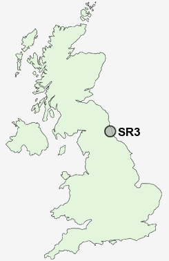
Postcode : SR3, Sunderland, Tyne And Wear
Postcodes in the SR3 sector. Covering areas such as Farringdon, Tunstall, East Herrington, New Silksworth, Burdon, Doxford Park, Middle Herrington, Thorney Close and Sunderland in Tyne and Wear, Tyne And Wear.
Postcode Area SR : Sunderland
SR3 Postcode Sectors
SR3 Nearby Postcode Districts
DH1 DH2 DH3 DH4 DH5 DH7 DH9 NE1 NE10 NE11 NE16 NE21 NE31 NE32 NE34 NE35 NE36 NE37 NE38 NE39 NE4 NE40 NE6 NE8 NE9 NE99 SR1 SR2 SR3 SR4 SR5 SR6 SR7 SR9
Stations near to SR3
Sunderland Rail Station about 2.35 miles away.St Peters Rail Station about 2.68 miles away.
SR3 Schools
New Silksworth Infant SchoolNew Silksworth Junior School
Thorney Close Primary School
Farringdon Community Sports College
Plains Farm Primary School
Mill Hill Primary School
Sandhill View School
East Herrington Primary School
Richard Avenue Primary School
Hill View Infant School
UK Search
Antique Furniture
1000s of pieces of Antique Furniture for sale from British antique dealers.