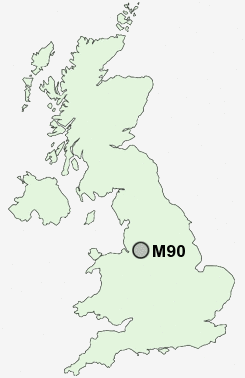
Postcode : M90, Greater Manchester
Postcodes in the M90 sector. Covering areas such as Greater Manchester in Greater Manchester.
Postcode Area M : Manchester
M90 Postcode Sectors
M90 Nearby Postcode Districts
M13 M14 M16 M18 M19 M20 M21 M22 M23 M31 M32 M33 M34 M41 M44 M90 SK1 SK10 SK12 SK13 SK14 SK2 SK22 SK23 SK3 SK4 SK5 SK6 SK7 SK8 SK9 WA1 WA12 WA13 WA14 WA15 WA16 WA2 WA3 WA4 WA5
Stations near to M90
Manchester Airport Rail StationHeald Green Rail Station about 1.72 miles away.
Styal Rail Station about 1.82 miles away.
Gatley Rail Station about 2.8 miles away.
M90 Schools
Elmridge Primary SchoolNewall Green High School
Styal Primary School
Peel Hall Primary School
Well Green Primary School
UK Search
Antique Furniture
1000s of pieces of Antique Furniture for sale from British antique dealers.