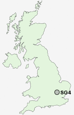
Postcode : SG4, Hertfordshire
Postcodes in the SG4 sector. Covering areas such as Damask Green, Porter's End, Hall's Green, Codicote Bottom, Walsworth, Ley Green, Kimpton, Purwell, St Ippollyts, St Paul's Walden, Breachwood Green, Hitchin, Rusling End, Whitwell and Hertfordshire.
Postcode Area SG : Stevenage
SG4 Postcode Sectors
SG4 8 Ansells End, Bendish, Breachwood Green, Codicote, Codicote Bottom
SG4 7 Church End, Damask Green, Graveley, Great Wymondley, Green End
SG4 7 Church End, Damask Green, Graveley, Great Wymondley, Green End
SG4 Nearby Postcode Districts
AL6 LU1 LU2 LU3 LU4 LU5 LU6 SG1 SG10 SG11 SG15 SG16 SG2 SG3 SG4 SG5 SG6 SG7 SG9
Stations near to SG4
Hitchin Rail Station about 2.24 miles away.SG4 Schools
Wymondley Junior Mixed and Infant SchoolWhitehill Junior School
Mary Exton Primary School
Highbury Infant School and Nursery
William Ransom Primary School
Hitchin Girls' School
UK Search
Antique Furniture
1000s of pieces of Antique Furniture for sale from British antique dealers.