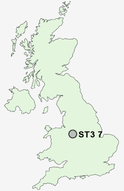
Postcode : ST3 7, Stoke-on-Trent, Staffordshire
Postcodes in the ST3 7 district. Covering areas such as Meir Heath, Leadendale, Rough Close, Normacot, Lightwood and Stoke-on-Trent in Staffordshire.
Postcode Area ST : Stoke on Trent
ST3 Postcode Sectors
ST3 5 Adderley Green, Hulme, Sandford Hill, Weston Coyney
ST3 3 Blurton, Newstead
ST3 4 Dresden, Florence, Hartwell
ST3 3 Blurton, Newstead
ST3 4 Dresden, Florence, Hartwell
ST3 2 Heron Cross, Hollybush, Longton
ST3 7 Leadendale, Lightwood, Meir Heath, Normacot, Rough Close
ST3 6 Meir
ST3 7 Leadendale, Lightwood, Meir Heath, Normacot, Rough Close
ST3 6 Meir
ST3 7 Nearby Postcode Districts
CW3 DE6 ST1 ST10 ST11 ST12 ST14 ST15 ST2 ST21 ST3 ST4 ST5 ST9 TF9
Stations near to ST3 7
Blythe Bridge Rail Station about 2.19 miles away.Longton Rail Station about 2.75 miles away.
Stone Rail Station about 3.54 miles away.
ST3 7 Schools
Meir Heath Primary SchoolGrange Primary School
Sandon Business and Enterprise College
St Augustine's RC (A) Primary School
Newstead Primary School
Alexandra Junior School
UK Search
Antique Furniture
1000s of pieces of Antique Furniture for sale from British antique dealers.