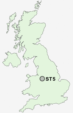
Postcode : ST5, Staffordshire
Postcodes in the ST5 sector. Covering areas such as Seabridge, Basford, Maer, Porthill, Wolstanton, Hawthorns, May Bank, Sidway, Brampton, The, Shelton under Harley, Chapel Chorlton, Clayton, Beasley, Blackbrook, Finney Green and Staffordshire.
Postcode Area ST : Stoke on Trent
ST5 Postcode Sectors
ST5 4 Acton, Butterton, Northwood, Shelton under Harley, The Rowe
ST5 6 Apedale, Blank Bank, Finney Green, Knutton, Leycett
ST5 5 Baldwin's Gate, Blackbrook, Chapel Chorlton, Coombesdale, Hawthorns
ST5 1 Basford, Newcastle-under-Lyme
ST5 7 Beasley, Broad Meadow, Chesterton, Crackley
ST5 6 Apedale, Blank Bank, Finney Green, Knutton, Leycett
ST5 5 Baldwin's Gate, Blackbrook, Chapel Chorlton, Coombesdale, Hawthorns
ST5 1 Basford, Newcastle-under-Lyme
ST5 7 Beasley, Broad Meadow, Chesterton, Crackley
ST5 8 Bradwell, Dimsdale
ST5 2 Brampton, The
ST5 3 Clayton, Seabridge, Westlands
ST5 9 Cross Heath, May Bank
ST5 0 Porthill, Wolstanton
ST5 2 Brampton, The
ST5 3 Clayton, Seabridge, Westlands
ST5 9 Cross Heath, May Bank
ST5 0 Porthill, Wolstanton
ST5 Nearby Postcode Districts
CW1 CW2 CW3 CW5 ST1 ST10 ST11 ST12 ST13 ST2 ST3 ST4 ST5 ST6 ST7 ST8 ST9
Stations near to ST5
Longport Rail Station about 2.04 miles away.ST5 Schools
Hassell Primary SchoolHempstalls Primary School
Friarswood Primary School
Westlands Primary School
Harpfield Primary School
May Bank Infants' School
Silverdale Primary School
Churchfields Primary School
Bradwell Primary School
UK Search
Antique Furniture
1000s of pieces of Antique Furniture for sale from British antique dealers.