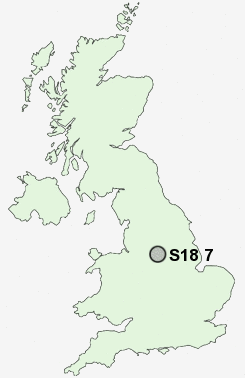
Postcode : S18 7, Derbyshire
Postcodes in the S18 7 district. Covering areas such as Bole Hill, Barlow, Wilday Green, Holmesfield, Cartledge, Common Side, Crowhole, Lydgate, Brindwoodgate, Millthorpe, Unthank and Derbyshire.
Postcode Area S : Sheffield
S18 Postcode Sectors
S18 4 Apperknowle, Hundall, Summerley, Unstone, Unstone Green
S18 7 Barlow, Bole Hill, Brindwoodgate, Cartledge, Common Side
S18 3 Coal Aston
S18 7 Barlow, Bole Hill, Brindwoodgate, Cartledge, Common Side
S18 3 Coal Aston
S18 8 Cowley, Dronfield Woodhouse, Gosforth Valley, Mickley
S18 2 Dronfield, Holmesdale, Holmley Common, Snape Hill
S18 1 Hallowes, Hill Top
S18 2 Dronfield, Holmesdale, Holmley Common, Snape Hill
S18 1 Hallowes, Hill Top
S18 7 Nearby Postcode Districts
DE45 NG20 S11 S12 S13 S14 S17 S18 S20 S21 S26 S32 S33 S40 S41 S42 S43 S44 S7 S8 S80 S81 SK17
Stations near to S18 7
Dronfield Rail Station about 3.05 miles away.S18 7 Schools
Barlow CofE Primary SchoolCutthorpe Primary School
Wigley Primary School
UK Search
Antique Furniture
1000s of pieces of Antique Furniture for sale from British antique dealers.