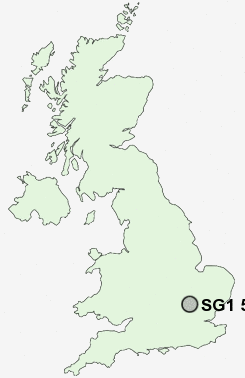
Postcode : SG1 5, Hertfordshire
Postcodes in the SG1 5 district. Covering areas such as Pin Green and Hertfordshire.
Postcode Area SG : Stevenage
SG1 Postcode Sectors
SG1 1 Bedwell, Stevenage
SG1 4 Fishers Green, St Nicholas, Todd's Green
SG1 2 Norton Green, Symonds Green
SG1 4 Fishers Green, St Nicholas, Todd's Green
SG1 2 Norton Green, Symonds Green
SG1 5 Nearby Postcode Districts
AL5 AL6 CM23 CM24 LU1 LU2 LU3 LU4 LU5 LU6 SG1 SG10 SG11 SG15 SG2 SG3 SG4 SG5 SG6 SG7 SG9
Stations near to SG1 5
Stevenage Rail Station about 1.09 miles away.Knebworth Rail Station about 3.27 miles away.
SG1 5 Schools
Trotts Hill Primary and Nursery SchoolBarclay School
Giles Junior School
The Giles Infant and Nursery School
The Thomas Alleyne School
The Leys Primary and Nursery School
The Nobel School
Marriotts School
Round Diamond Primary School
Ashtree Primary School and Nursery
Barnwell School
UK Search
Antique Furniture
1000s of pieces of Antique Furniture for sale from British antique dealers.