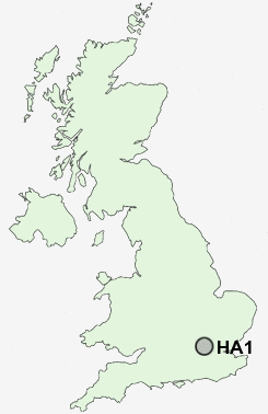
Postcode : HA1, Greater London, London
Postcodes in the HA1 sector. Covering areas such as Harrow, Greenhill, West Harrow, Harrow on the Hill and Greater London in Harrow, Greater London.
Postcode Area HA : Harrow
HA1 Postcode Sectors
HA1 Nearby Postcode Districts
E1 E10 E11 E12 E13 E14 E15 E16 E17 E18 E1W E2 E3 E4 E5 E6 E7 E8 E9 EC1 EC1A EC1M EC1N EC1R EC1V EC1Y EC2 EC2A EC2M EC2N EC2R EC2V EC2Y EC3 EC3A EC3M EC3N EC3P EC3R EC3V EC4 EC4A EC4M EC4N EC4R EC4V EC4Y EN1 EN2 EN3 EN4 EN5 HA0 HA1 HA2 HA3 HA4 HA5 HA6 HA7 HA8 HA9 HP10 HP15 HP6 HP7 HP8 HP9 IG4 IG8 IG9 N1 N10 N11 N12 N13 N14 N15 N16 N17 N18 N19 N2 N20 N21 N22 N3 N4 N5 N6 N7 N8 N9 NW1 NW10 NW11 NW2 NW3 NW4 NW5 NW6 NW7 NW8 NW9 SE1 SE10 SE11 SE16 SE17 SE7 SE8 SL0 SL1 SL2 SL3 SL6 SL8 SL9 SW1 SW10 SW1A SW1E SW1H SW1P SW1V SW1W SW1X SW1Y SW3 SW5 SW7 TW5 TW8 UB1 UB10 UB11 UB2 UB3 UB4 UB5 UB6 UB7 UB8 UB9 W1 W10 W11 W12 W13 W14 W1B W1C W1D W1F W1G W1H W1J W1K W1M W1S W1T W1U W1W W2 W3 W4 W5 W6 W7 W8 W9 WC1 WC1A WC1B WC1E WC1H WC1N WC1R WC1V WC1X WC2 WC2A WC2B WC2E WC2H WC2N WC2R WD1 WD17 WD18 WD19 WD2 WD23 WD24 WD3 WD6
Stations near to HA1
Harrow-on-the-Hill Rail StationKenton Rail Station about 0.83 miles away.
Harrow & Wealdstone Rail Station about 0.84 miles away.
Harrow & Wealdstone Rail Station about 0.84 miles away.
Headstone Lane Rail Station about 1.81 miles away.
Hatch End Rail Station about 2.47 miles away.
Greenford Rail Station about 2.64 miles away.
Carpenders Park Rail Station about 3.97 miles away.
HA1 Schools
Harrow High School and Sports CollegeWhitmore High School
Priestmead Primary School and Nursery
Nower Hill High School
Longfield Primary School
Rooks Heath High School
Weald Middle School
UK Search
Antique Jewellery
including Antique Engagement Rings for sale from UK Antique specialists.