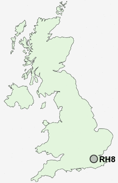
Postcode : RH8, Surrey
Postcodes in the RH8 sector. Covering areas such as Holland, Limpsfield Common, Broadham Green, Limpsfield Chart, Hurst Green, Limpsfield, Pains Hill, Merle Common, Titsey, Crowhurst Lane End, Tandridge, Oxted and Surrey.
Postcode Area RH : Redhill
RH8 Postcode Sectors
RH8 Nearby Postcode Districts
CR2 CR3 CR5 CR6 CR8 KT17 KT18 KT19 KT20 KT21 KT22 KT23 RH1 RH2 RH3 RH4 RH5 RH6 RH7 RH8 RH9 SM7 TN10 TN11 TN13 TN14 TN15 TN16 TN8 TN9
Stations near to RH8
Hurst Green Rail Station about 0.46 miles away.Oxted Rail Station about 0.58 miles away.
Oxted Rail Station about 0.58 miles away.
RH8 Schools
Hazelwood SchoolHurst Green Infant School
Oxted School
Laverock School
Limpsfield CofE Infant School
St Mary's CofE Junior School
Downs Way School
Holland Junior School
St Peter's CofE Infant School
UK Search
Antique Furniture
1000s of pieces of Antique Furniture for sale from British antique dealers.