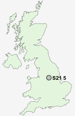
Postcode : S21 5, Derbyshire
Postcodes in the S21 5 district. Covering areas such as Bramley, West Handley, Middle Handley, Nether Handley, Troway, Greenside, Marsh Lane and Derbyshire.
Postcode Area S : Sheffield
S21 Postcode Sectors
S21 5 Bramley, Greenside, Marsh Lane, Middle Handley, Nether Handley
S21 4 Eckington
S21 3 Emmett Carr, Renishaw, Spinkhill
S21 4 Eckington
S21 3 Emmett Carr, Renishaw, Spinkhill
S21 5 Nearby Postcode Districts
DE45 NG20 S1 S10 S11 S12 S13 S14 S17 S18 S2 S20 S21 S25 S26 S3 S32 S33 S40 S41 S42 S43 S44 S7 S8 S80 S81
S21 5 Schools
Unstone St Mary's Infant SchoolNew Whittington Community Primary School
Unstone Junior School
Whittington Green School
Mary Swanwick Community Primary School
Eckington School
UK Search
Antique Furniture
1000s of pieces of Antique Furniture for sale from British antique dealers.