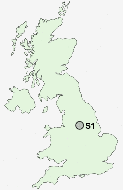
Postcode : S1, Sheffield, South Yorkshire
Postcodes in the S1 sector. Covering areas such as Sandygate, Lodge Moor, Hallowes, Holmley Common, Crowhole, Townhead, Cowley, Greystones, Totley, Dronfield, Common Side, Bassett, Whirlow Brook, Holmesfield, Sheffield and Derbyshire in South Yorkshire.
Postcode Area S : Sheffield
S1 Postcode Sectors
S1 Nearby Postcode Districts
DN11 S1 S10 S11 S12 S13 S14 S17 S18 S2 S20 S21 S25 S26 S3 S32 S33 S35 S4 S5 S6 S60 S61 S62 S65 S66 S7 S8 S80 S81 S9
Stations near to S1
Sheffield Rail Station about 0.27 miles away.S1 Schools
Netherthorpe Primary SchoolSharrow Nursery, Infant and Junior School
King Edward VII School
Anns Grove Primary School
Westways Primary School
Walkley Primary School
Carfield Primary School
UK Search
Antique Furniture
1000s of pieces of Antique Furniture for sale from British antique dealers.