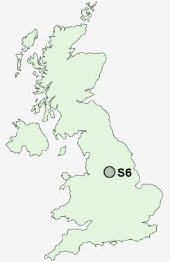
Postcode : S6, Sheffield, South Yorkshire
Postcodes in the S6 sector. Covering areas such as Wath Upon Dearne, Braithwell, Greasbrough, Catcliffe, Hollow Meadows, Maltby, Dalton Parva, Sunnyside, Birley Carr, Malin Bridge, Orgreave, Meadow Hall, Thrybergh, Jordon, Barrow, Rotherham, Sheffield and Barnsley in South Yorkshire.
Postcode Area S : Sheffield
S6 Postcode Sectors
S6 1 Birley Carr, Birley Edge, Wadsley Bridge
S6 6 Dungworth, Edge Mount, Hall Broom, High Bradfield, Hill Top
S6 4 Hillsborough, Malin Bridge, Wadsley
S6 6 Dungworth, Edge Mount, Hall Broom, High Bradfield, Hill Top
S6 4 Hillsborough, Malin Bridge, Wadsley
S6 Nearby Postcode Districts
DN12 S1 S10 S11 S12 S13 S14 S17 S2 S20 S21 S25 S26 S3 S33 S35 S4 S5 S6 S60 S61 S62 S64 S65 S66 S7 S74 S8 S81 S9
Stations near to S6
Sheffield Rail Station about 2.57 miles away.S6 Schools
Malin Bridge Primary SchoolLoxley Primary School
Nook Lane Junior School
Netherthorpe Primary School
Stannington Infant School
Southey Green Community Primary School and Nurseries
King Edward VII School
UK Search
Antique Furniture
1000s of pieces of Antique Furniture for sale from British antique dealers.