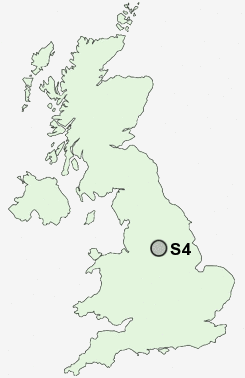
Postcode : S4, Sheffield, South Yorkshire
Postcodes in the S4 sector. Covering areas such as Northedge, Glapwell, Oxton Rakes, Pitsmoor, Inkersall Green, Highfields, Boythorpe, Clowne, Nether Moor, North Wingfield, Ashover, Palterton, Loundsley Green, Stonegravels, Holymoorside, Derbyshire and Sheffield in South Yorkshire.
Postcode Area S : Sheffield
S4 Postcode Sectors
S4 Nearby Postcode Districts
DN11 DN12 S1 S10 S11 S12 S13 S14 S17 S18 S2 S20 S21 S25 S26 S3 S33 S35 S4 S5 S6 S60 S61 S62 S64 S65 S66 S7 S8 S81 S9
Stations near to S4
Sheffield Rail Station about 1.52 miles away.Darnall Rail Station about 1.84 miles away.
Meadowhall Rail Station about 1.99 miles away.
S4 Schools
Limpsfield Junior SchoolNetherthorpe Primary School
Concord Junior School
Southey Green Community Primary School and Nurseries
Acres Hill Community Primary School
Firth Park Community Arts College
UK Search
Antique Furniture
1000s of pieces of Antique Furniture for sale from British antique dealers.