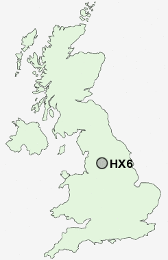
Postcode : HX6, Calderdale, West Yorkshire
Postcodes in the HX6 sector. Covering areas such as Rishworth, Kebroyd, Longley, Sowerby Bridge, Mill Bank, Clough Head, Pike Law, Booth Wood, Hubberton Green, Steep Lane, Triangle, Cotton Stones, Sowerby, Ripponden and Calderdale in West Yorkshire.
Postcode Area HX : Halifax
HX6 Postcode Sectors
HX6 4 Booth Wood, Cotton Stones, Pike End, Pike Law, Ripponden
HX6 1 Boulder Clough, Hubberton Green, Sowerby, Steep Lane
HX6 1 Boulder Clough, Hubberton Green, Sowerby, Steep Lane
HX6 Nearby Postcode Districts
BB11 BB4 BD1 BD11 BD12 BD13 BD14 BD19 BD3 BD4 BD5 BD6 BD7 BL0 HD1 HD2 HD3 HD4 HD5 HD6 HD7 HD8 HX1 HX2 HX3 HX4 HX5 HX6 HX7 LS1 LS10 LS11 LS12 LS27 OL11 OL12 OL13 OL14 OL15 OL16 WF12 WF13 WF14 WF15 WF16 WF17 WF3 WF5
Stations near to HX6
Sowerby Bridge Rail Station about 0.97 miles away.HX6 Schools
Tuel Lane Infant SchoolSowerby Bridge High School
Luddendenfoot Junior and Infant School
Bolton Brow Junior Infant and Nursery School
Warley Town School
Ripponden Junior and Infant School
Warley Road Primary School
UK Search
Antique Jewellery
including Antique Engagement Rings for sale from UK Antique specialists.