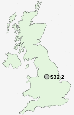
Postcode : S32 2, Derbyshire
Postcodes in the S32 2 district. Covering areas such as Grindleford, Upper Padley, Nether Padley, Leam and Derbyshire.
Postcode Area S : Sheffield
S32 Postcode Sectors
S32 1 Abney, Hathersage, Hathersage Booths, Leadmill
S32 5 Bretton, Eyam, Foolow, Highcliffe
S32 3 Calver, Calver Sough, Curbar, Froggatt
S32 5 Bretton, Eyam, Foolow, Highcliffe
S32 3 Calver, Calver Sough, Curbar, Froggatt
S32 2 Nearby Postcode Districts
DE45 S1 S10 S11 S12 S13 S14 S17 S18 S2 S20 S21 S26 S3 S32 S33 S4 S40 S41 S43 S44 S6 S7 S8 S9 SK17 SK22 SK23
Stations near to S32 2
Grindleford Rail Station about 0.53 miles away.Hathersage Rail Station about 1.21 miles away.
S32 2 Schools
Grindleford Primary SchoolHathersage St Michael's CofE (Aided) Primary School
UK Search
Antique Furniture
1000s of pieces of Antique Furniture for sale from British antique dealers.