Postcode : S33 7, Derbyshire
Postcodes in the S33 7 district. Covering areas such as Ollerbrook Booth, Grindsbrook Booth, Nether Booth, Barber Booth, Upper Booth, Edale and Derbyshire.
Postcode Area S : Sheffield
S33 Postcode Sectors
S33 0 Ashopton, Bamford, Shatton, Thornhill
S33 6 Aston, Edale End, Hope
S33 7 Barber Booth, Edale, Grindsbrook Booth, Nether Booth, Ollerbrook Booth
S33 6 Aston, Edale End, Hope
S33 7 Barber Booth, Edale, Grindsbrook Booth, Nether Booth, Ollerbrook Booth
S33 7 Nearby Postcode Districts
M12 M13 M14 M18 M19 M20 M34 S1 S10 S11 S17 S18 S2 S3 S32 S33 S35 S4 S5 S6 S7 S8 SK1 SK10 SK12 SK13 SK14 SK2 SK22 SK23 SK3 SK4 SK5 SK6 SK7 SK8 SK9
Stations near to S33 7
Edale Rail Station about 1.12 miles away.S33 7 Schools
Edale CofE Primary School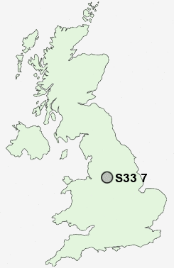
UK Search
Antique Furniture
1000s of pieces of Antique Furniture for sale from British antique dealers.