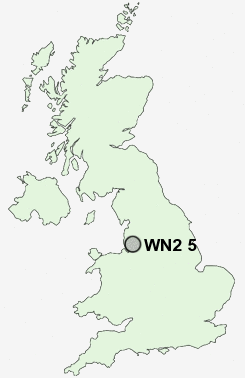
Postcode : WN2 5, Wigan, Greater Manchester
Postcodes in the WN2 5 district. Covering areas such as Platt Bridge, Bamfurlong, Abram, Dover, Bryn Gates, Bickershaw and Wigan in Greater Manchester.
Postcode Area WN : Wigan
WN2 Postcode Sectors
WN2 5 Abram, Bamfurlong, Bickershaw, Bryn Gates, Dover
WN2 1 Aspull, Haigh, New Springs, Pennington Green, Top Lock
WN2 1 Aspull, Haigh, New Springs, Pennington Green, Top Lock
WN2 5 Nearby Postcode Districts
BL1 BL2 BL3 BL4 BL5 BL6 BL8 BL9 L10 L11 L12 L14 L20 L28 L29 L30 L31 L32 L33 L34 L39 L4 L40 L5 L6 L9 M1 M12 M13 M14 M15 M16 M17 M2 M20 M21 M25 M26 M27 M28 M29 M3 M30 M31 M32 M33 M38 M4 M41 M44 M45 M46 M5 M6 M60 M7 M8 M9 OL10 WA10 WA11 WA12 WA3 WA9 WN1 WN2 WN3 WN4 WN5 WN6 WN7 WN8
Stations near to WN2 5
Ince (Manchester) Rail Station about 1.58 miles away.Hindley Rail Station about 1.92 miles away.
Wigan North Western Rail Station about 2.33 miles away.
Wigan Wallgate Rail Station about 2.39 miles away.
WN2 5 Schools
Platt Bridge Community Primary SchoolAbram Bryn Gates Primary School
Hindley Junior and Infant School
Britannia Bridge Primary School
Hawkley Hall High School
St William's Catholic Primary School
Hindley High School
UK Search
Antique Furniture
1000s of pieces of Antique Furniture for sale from British antique dealers.