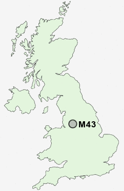
Postcode : M43, Tameside, Greater Manchester
Postcodes in the M43 sector. Covering areas such as Fairfield, Droylsden, Woodhouses, Daisy Nook, Littlemoss, Greenside and Tameside in Greater Manchester.
Postcode Area M : Manchester
M43 Postcode Sectors
M43 Nearby Postcode Districts
BL3 BL4 BL5 HD9 M1 M11 M12 M13 M14 M15 M16 M17 M18 M19 M2 M20 M21 M22 M23 M24 M25 M26 M27 M28 M29 M3 M30 M31 M32 M33 M34 M35 M38 M4 M40 M41 M43 M44 M45 M46 M5 M6 M60 M7 M8 M9 OL1 OL2 OL3 OL4 OL5 OL6 OL7 OL8 OL9 SK1 SK13 SK14 SK15 SK16 SK2 SK3 SK4 SK5 SK6 WA14 WA15 WA3 WN7
Stations near to M43
Fairfield Rail Station about 0.81 miles away.Gorton Rail Station about 1.22 miles away.
Guide Bridge Rail Station about 1.52 miles away.
Denton Rail Station about 1.93 miles away.
Belle Vue Rail Station about 1.95 miles away.
Ashburys Rail Station about 2.06 miles away.
Moston Rail Station about 2.95 miles away.
Levenshulme Rail Station about 3.25 miles away.
M43 Schools
Moorside Primary SchoolGreenside Primary School
Fairfield Road Primary School
Manchester Road Primary School
Aldwyn Primary School
Ashton West End Primary School
Poplar Street Primary School
Denton West End Primary School
UK Search
Antique Furniture
1000s of pieces of Antique Furniture for sale from British antique dealers.